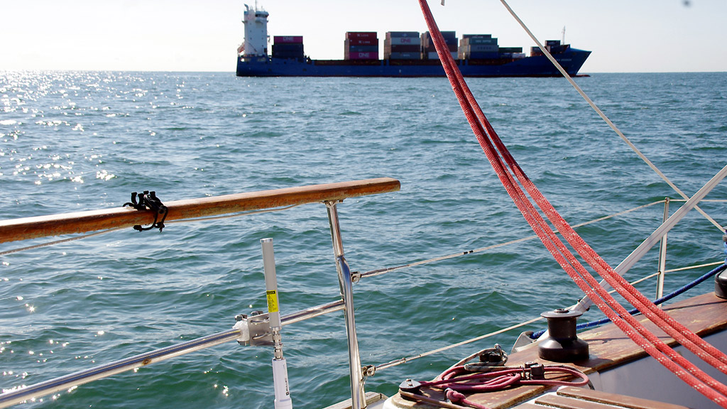
Connecting an Automatic Identification System (AIS) to a tablet like the iPad offers reassuring anti-collision functionality, especially as the tablet's portability makes it easy to monitor from anywhere on the boat.
The Automatic Identification System (AIS) is a VHF ship-to-ship communication system that facilitates the exchange of crucial collision-avoidance information. Required on large merchant ships, its use is becoming more widespread in pleasure boating thanks to lower equipment costs.
AIS receives information from nearby vessels, such as their name and characteristics (size, maneuverability, etc.), as well as their trajectory (course and speed over ground).
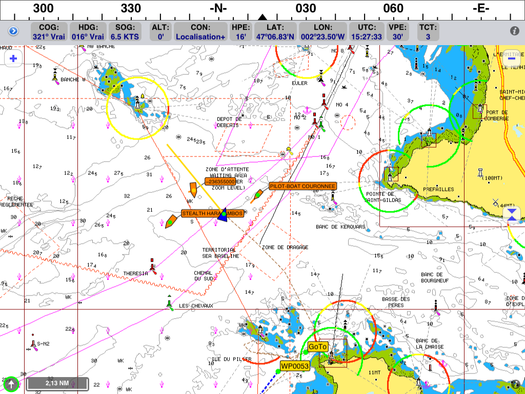
This data is displayed graphically, each vessel being represented by a symbol, a name tag and its trajectory, similar to what is used in air traffic control.
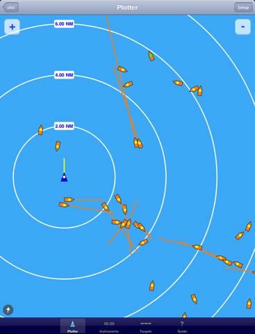
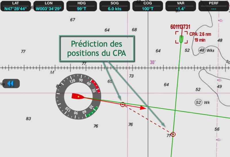
These data are used to assess the risk of collision and to define alerts based on two criteria:
An application such as Weather4D Routing & Navigation also calculates the anticipated position of the two vessels at the time of the CPA.
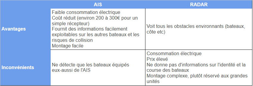
AIS should not be confused with radar, even though it has a similar objective - to detect obstacles in the vicinity. Each equipment has its own advantages and disadvantages, and it's best to use them together!
For small craft looking for a cost-effective detection solution, AIS is an excellent alternative to radar, and very useful for navigation in dense traffic areas or near cargo rails, for example.
An AIS receiver provides security by allowing you to see surrounding traffic, but it doesn't allow other vessels to detect you. For this, you need a transponder to broadcast your position.
Using a transponder increases your safety (you're more likely to be spotted) and contributes to the overall AIS ecosystem, which would be useless if there were only receivers without transmitters.
Historically, transponder prices have been high, but more affordable wifi-equipped models are beginning to emerge on the market. An alternative is to connect a wired AIS transponder to a WiFi multiplexer.
There are a multitude of AIS receivers and transponders on the market, usually broadcasting data in NMEA 0183 or 2000 formats. To receive them on an iPad or Android device, you need to convert them into a WiFi signal.
If your boat already has an AIS system, whether independent or integrated with your VHF, you can use an NMEA-to-WiFi converter such as the Miniplex-3wi-n2k.
If you don't have AIS, you might consider a device with built-in WiFi, such as Digital Yacht 's iAISTX or Vesper Marine's XB-8000, the latter also offering NMEA0183/2000 connectivity for other equipment. More recently, the Nomad has been launched, offering an easy-to-install WiFi transponder via a USB port.
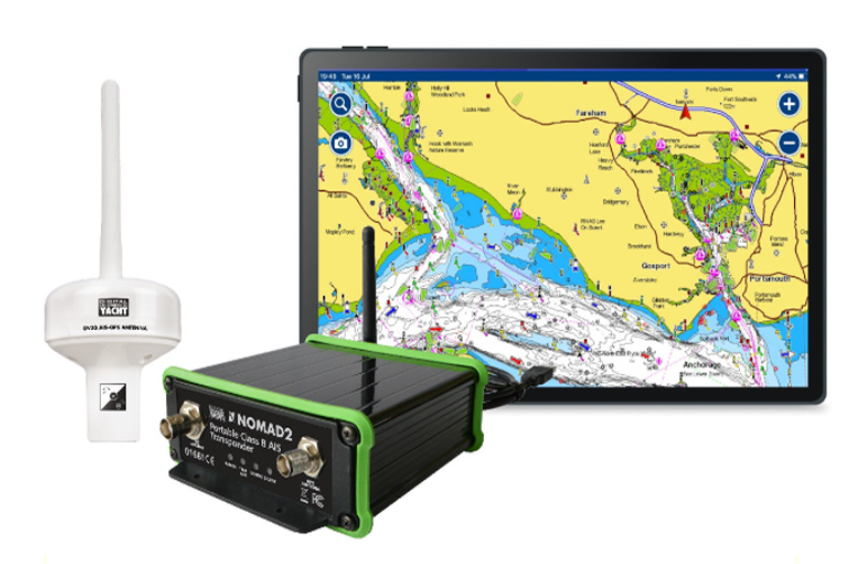
Once the AIS signal has been received on the tablet, it needs to be displayed. The choice is between "radar" or chart display.
The free iAIS "radar" application is notable for its ability to overlay AIS information on a Navionics chart (which does not qualify it as a true navigation application).
For full integration with a navigation application, including collision alarm management, several powerful applications are available, such as Weather4D Routing and Navigation, Sailgrib WR, iNavX and iSailor.
Find out more:
Our shop uses technical cookies to improve the user experience and we thank you for accepting their use to fully enjoy your browsing. These cookies are not used for advertising purposes. Thank you for your understanding.
